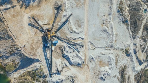
Buenaventura

PERU
Exploration
Discover
Marco Escalante – GIS Analyst
Compañía de Minas Buenaventura S.A.A. is a Peruvian precious metals producer with over 70 years of experience in exploration, development, construction and mining operations.
The company commenced its activities in 1953 with the acquisition of the Julcani Mine, in Huancavelica. Since then, they have worked to develop a business culture based on caring for the environment, as well as the health and safety of all our employees, and respect for the communities.
They are the first Latin American mining company to list on the New York Stock Exchange, starting in 1996, and, as part of their mission, the company strives to apply the highest industry standards and promote continuous innovation.

In the past, Buenaventura was using a software package that was about to expire and no longer had updates. This situation affected their operations since the team did not have a software to makes sections using data from their enterprises, they began to use more advanced software whose power and capacity are not made for a simple process.
To resolve the issue, the company researched and studied various software solutions in the market, with the requirements of having the capability to work within the ArcGIS Pro environment and being able to complement 100% of their Enterprise solutions.

Discover for ArcGIS Pro brings all the Exploration focused tools from Discover to an Enterprise platform.
Incorporated in the industry leading ArcGIS Pro, Discover assists the exploration professional in their daily activities from data conversion, map making to field work.
The software allows users to import numerous geoscience specific data types, create cartographic quality drillhole plans and sections, as well as view all data in 3D.
The company has the data of all its standardised units in nomenclature, templates and coding. A single user generates a template and distributes it to all units.
The software is easy to use for both GIS operators, GIS analysts and geologists without much training in the software.
The cost reduction in the budget for purchasing and/or maintaining the platform, is equivalent to 10% or 20%, when compared to Buenaventura’s others corporate software.
Built as a plugin to ArcGIS Pro, Discover is a comprehensive package for the importation, centralisation and analysis of geosciences data, whether you are conducting mineral exploration, or environmental assessments.

Marco Escalante – GIS Analyst


The successful integration of Reconcilor and LiveMine has provided significant benefits to Bellevue.

Designed specifically by professionals in the industry, DataBlast enables operational improvement through its integrated and comprehensive design capabilities.

Peabody identified gaps within their operations and improved their overall technical capacity with Datamine's consultants.

See how corporate resource and reserve information with the quality, accuracy, and reliability required by geologists is delivered with Studio RM.

Enhanced automation and streamlined data tracking empowered Rio Tinto to optimise operations, saving up to one month annually in manual efforts.

Achieving over 95% accuracy in a complex historical mining district with the MineScape mine planning model.

As part of the improvements since the implementation of this solution, the processing time of data is much shorter.

With Datamine's Production Accounting, data sources are transparent, they are recorded and stakeholders know where the data came from.

Geological domaining is a crucial step in the resource modelling process. See how our solution can streamline this process.

See why Whitehaven Coal has expanded their use of Scenario from selected pilot projects to their entire portfolio.

A integração bem-sucedida do Reconcilor e LiveMine trouxe benefícios significativos para a Bellevue.
Discover how a leading mining and metals company in South Africa transformed its laboratory operations with Datamine’s CCLAS solution.
Enhancing laboratory operations with Datamine's CCLAS at a top-tier iron ore and lithium operator.

Öksüt Gold Mine, operated by Centerra Gold in Turkey, partnered with Datamine to implement CCLAS — a mining-specific LIMS.

Eramet chose Isatis.py, Geovariances’ Python geostatistics library, to standardize, secure, and industrialize resource estimation across dozens of mining sites. The scalable web platform delivers faster, reproducible, error‑reduced workflows with full traceability and seamless Isatis.neo integration.

GAC automated their systems and transformed their operations with MineMarket, saving over 60 labour-hours every day and enabling real-time inventory visibility from pit to port.

Iron Ore Producer Transforms Inventory Management with MineMarket.

Integrated GDMS Fusion solution enabled Nexa Resources to centralise and standardise geological data management across Brazil, Peru, and Namibia, ensuring secure, real-time access, improved data quality, and streamlined operations

Faced with sparse drilling data in the northern extension of its Rodoretto talc mine, Imerys leveraged the advanced simulation capabilities of Isatis.neo, first using multiple-point statistics (MPS) and then plurigaussian simulations (PGS), to model lithologies and grades, with methodological support from Geovariances.

Minera Florida partnered with Datamine to replace its legacy system with CCLAS, ensuring accurate, timely, and traceable results that support compliance, reporting, and production quality.

MineScape improved forecasts, boosted recovery, cut costs, and prevented delays by identifying and planning for adverse roof conditions.
Rio Tinto Yarwun modernised its laboratory operations by replacing a legacy LIMS with CCLAS, improving data reliability, streamlining workflows, and ensuring seamless integration with plant systems, without disrupting production.

Frontier Lithium adopted Discover for ArcGIS and Discover Mobile to replace manual workflows and improve mining exploration. What began as drillhole visualisation became a core platform for exploration, engineering and community engagement.

Hengjaya Mineralindo partnered with Datamine to standardise high-volume laboratory workflows with CCLAS, improving data reliability, traceability, and reporting for operational decisions.

Utilising best practice with Reconcilor enabled Evolution Mining to improve operational outcomes, meaning reduced processing time, improved data validation and accuracy, significantly improved stockpile balancing and easy comparison between variables.

Kamoa Copper transformed its smelter laboratory with Datamine CCLAS, moving from manual, paper-based workflows to a digitally integrated environment with automated sample registration, validation, reporting, and real-time data flow into operational systems.

Akara Resources implemented Datamine's CCLAS to create a seamless laboratory-to-geology data workflow. Through integration with laboratory instruments, downstream systems, and Datamine Fusion, the company improved data reliability, reduced manual effort, and ensured timely access to critical assay information.

GCO’s geology team is tasked with managing complex exploration and grade control processes, conducting extensive reverse circulation (RC) drilling across sand dunes.